.svg)
File:Karnataka topo deu.png
Size of this preview: 220 × 264 pixels. Other resolutions: 200 × 240 pixels | 312 × 375 pixels | 637 × 765 pixels.
Original file (637 × 765 pixels, file size: 893 KB, MIME type: image/png)
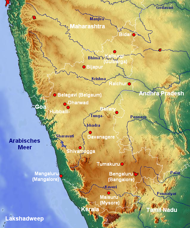
| Description | Topographische Karte von Karnataka (Indien) mit Städten und Flüssen |
| Date | |
| Source | www.maps-for-free.com |
| Author | Jungpionier |
This file is licensed under the Creative Commons Attribution-Share Alike 3.0 Unported license.
- You are free:
- to share – to copy, distribute and transmit the work
- to remix – to adapt the work
- Under the following conditions:
- attribution – You must give appropriate credit, provide a link to the license, and indicate if changes were made. You may do so in any reasonable manner, but not in any way that suggests the licensor endorses you or your use.
- share alike – If you remix, transform, or build upon the material, you must distribute your contributions under the same or compatible license as the original.
File history
Click on a date/time to view the file as it appeared at that time.
| Date/Time | Thumbnail | Dimensions | User | Comment | |
|---|---|---|---|---|---|
| current | 23:24, 26 February 2008 | | 637 × 765 (893 KB) | wikimediacommons>Jungpionier | {{Information |Description=Topographische Karte von Karnataka (Indien) mit Städten und Flüssen |Source=[http://www.maps-for-free.com/ www.maps-for-free.com] |Date=26. Februar 2008 |Author= Jungpionier }} {{cc-by-sa-3.0}} [[Categor |
File usage
The following 3 pages use this file: