.svg)
File:Railway map india ILN 1865.jpg
Size of this preview: 220 × 250 pixels. Other resolutions: 211 × 240 pixels | 330 × 375 pixels | 974 × 1,107 pixels.
Original file (974 × 1,107 pixels, file size: 782 KB, MIME type: image/jpeg)
| Description |
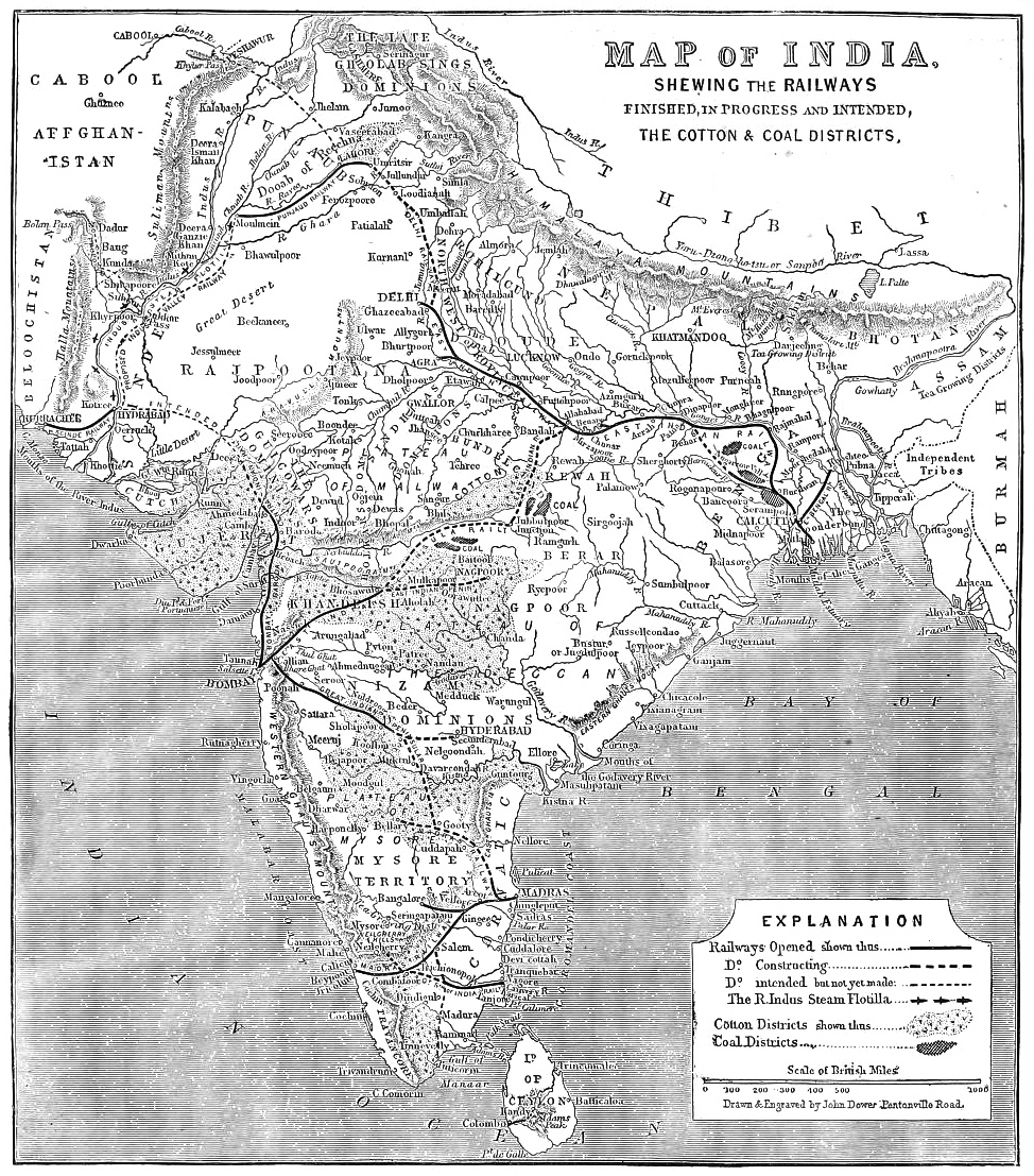
Railways map of India in 1865 |
|||||||||
| Date | ||||||||||
| Source | Illustrated London News April 29, 1865 | |||||||||
| Creator |
John Dower |
|||||||||
| Permission (Reusing this file) |
|
|||||||||
| Geotemporal data | ||||||||||
| Bounding box |
|
|||||||||
| Georeferencing | ||||||||||
File history
Click on a date/time to view the file as it appeared at that time.
| Date/Time | Thumbnail | Dimensions | User | Comment | |
|---|---|---|---|---|---|
| current | 11:41, 16 April 2014 | | 974 × 1,107 (782 KB) | wikimediacommons>Shyamal | {{Information |Description=Railways map of India in 1865 |Source=Illustrated London News April 29, 1865 |Date=1865 |Author=John Dower |Permission={{pd-1923}} |other_versions= }} Category:Indian Railways |
File usage
The following 2 pages use this file: