Forbesganj Airport
Forbesganj Airport फारबिसगंज हवाई अड्डा | |||||||||||
|---|---|---|---|---|---|---|---|---|---|---|---|
| Summary | |||||||||||
| Airport type | Public | ||||||||||
| Operator | Airports Authority of India | ||||||||||
| Location | Forbesganj, Bihar, India | ||||||||||
| Elevation AMSL | 204.4 ft / 62 m | ||||||||||
| Coordinates | 26°17′48.5″N 087°17′2.52″E / 26.296806°N 87.2840333°ECoordinates: 26°17′48.5″N 087°17′2.52″E / 26.296806°N 87.2840333°E | ||||||||||
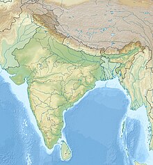
| Map | |||||||||||
| Runways | |||||||||||
| |||||||||||
Forbesganj Airport is a non operational airport located at Araria District in the state of Bihar, India maintained by the AAI.
History[edit]
Historically Forbesganj had a functional military airport between 1934 to 1942 (active during World War II) and again during the 1962 war with China. On 10 June 1973 a Royal Nepal Airlines DHC-6 Twin Otter Plane was hijacked en route to Kathmandu from Biratnagar. This airport has now fallen into disrepair and is not operational.
Transport[edit]
The nearest active airport to Forbesganj is Biratnagar (Nepal). Closest domestic airports are Darbhanga Airport in Darbhanga, Bihar and Bagdogra Airport in Siliguri, West Bengal, both about 160 km away. Jay Prakash Narayan International Airport in the Bihar state's capital city Patna is approximately 300 km. away. From Bagdogra Airport it takes 3–4 hours to reach the city by road.
Specifications[edit]
The airport has been built on a 53 acres land area, located 5 km from the city.[1][2]
The airport is located at an elevation of 193 feet (59 m) above mean sea level. It has one paved runway designated 09/27 oriented by measures of dimension 5000 ft x 500 ft with asphalt surface.[3]
The airport was declared non operational by the Airports Authority of India.[4]
References[edit]
- ↑ "AAI Jogbani Airport".
{{cite web}}: CS1 maint: url-status (link) - ↑ Ltd, rome2rio Pty. "How to get to Jogbani from 5 nearby airports". Rome2rio. Archived from the original on 12 October 2013. Retrieved 25 July 2020.
- ↑ "Jogbani Airport - IndiaAirport.com". indiaairport.com. Archived from the original on 21 January 2020. Retrieved 25 July 2020.
- ↑ "AAI spent Rs 4 crore in 2018-19 to maintain 26 non-operational airports'". DNA India. 30 June 2019. Archived from the original on 1 July 2019. Retrieved 25 July 2020.


