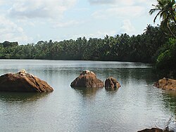
Souparnika River
Thank you for being part of the Bharatpedia family! 0% transparency: ₹0 raised out of ₹100,000 (0 supporter) |
Souparnika River or Sowparnika nadi is a river flowing through Kundapur taluk in Karnataka, India. It joins with the Varahi River, Kedaka River, Chakra River, and Kubja River known as Panchagangavali river and merges into the Arabian Sea. It flows near Mookambika temple, Kollur hence sometimes known as Kolluru nadi and is considered holy river by devotees of the temple.[1]
It is believed that Garuda (eagle) called Suparna performed penance on the banks of the river and attained salvation thus the name become Souparnika. It is also believed that river absorbs the elements of 64 different medicinal plants and roots as it flows, therefore it cures diseases of those who bath in it.
Distances from Kollur[edit]
- Kundapura: 40 km
- Udupi: 80 km
- Murudeshwara: 55 km
- Mangalore: 140 km
- Bangalore: 405 km (via Shimoga)
- Sringeri: 115 km
References[edit]
- ↑ Prabhu, Ganesh (27 February 2014). "Souparnika river chokes on sewage, plastic". The Hindu, Newspaper. Retrieved 29 August 2015.

